8:30am: You just hopped in your car for a quick dash across town to make that 9am appointment.
9:15am: You are still sitting in bumper to bumper traffic, watching as pedestrians hurry past and cursing the decision to pick up the car keys.
9:25am: Finally arriving at your appointment, you reflect that maybe hopping on a bike was a smarter option.
Anyone who has been stuck in city traffic knows that the fastest way from A to B is not always by car, and that public transit, biking or even walking can be a better choice. Well, now you can stop playing transportation roulette and start navigating with confidence. Starting today on iOS (already available on Android), Google Maps will show you travel times for all transportation types on just one screen so you can easily compare your options and get where you’re going as quickly as possible.
With live traffic and public transit information reflecting delays and cancellations, Google Maps will quickly compare transport options in real-time to give you the right information, right when you need it. Once you’ve selected your mode of transportation, Google Maps goes the extra mile to provide you with alternate routes directly on the map.
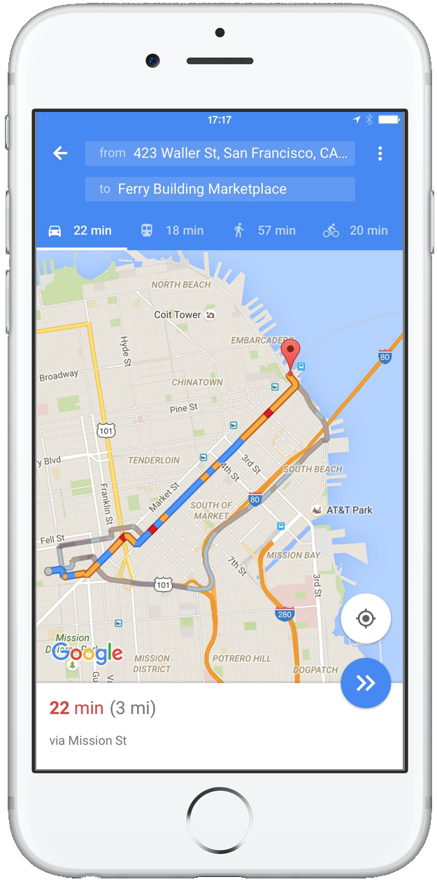
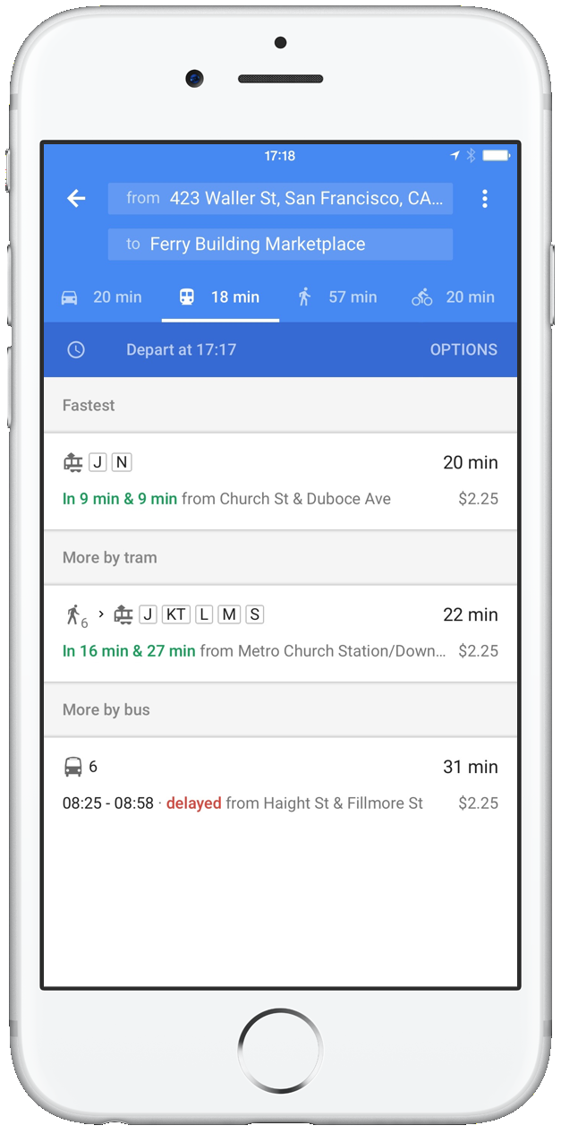
All you need to know is where you want to go. Google Maps for mobile will provide you with the most detailed and useful information so you can make the best decision—whether that means picking up your keys, bike helmet or bus pass.